|
Day 47, 48, 49 & 50
| August 22nd, 23rd, 24th & 25th. 2007 |
From Daniel's Summit ToTucker, Utah.
Marc: ''From this point on, there should be trails availables for quads. We're only at
about 20 miles from the campground at Strawberry Reservoir so, even if it's already
8:00pm, we should be able to get there and set up camp before dark. The trail looks easy
to follow, according to my map.''
France: ''Cool!''
The trail is VERY rocky, we have to take it VERY slowly. It will definetely take longer
than expected...
2 hours later, in total darkness, the trail ends...On a paved road...About 1/2 mile
from the campground...Heck ! Let's check it out !
Marc: ''AH NO !....THAT'S GOT TO BE A JOKE !!!!...Right at the campground entrance,
there's a big sign that says "NO ATVs"
France: ''Oh Oh... I predict another big camp (map) fire!!!
We back track to the trail and pitch the tent in a open area (field). Hurry-up before
it starts raining !
In the morning, after being shaken rattled and rolled all night by the wind and rain
(at least, one thing's for sure, the tent is watertight...), we get out of the tent just
in time to see the last clouds roll by.
Yesterday, we were planning on staying here a couple of days to enjoy the
reservoir...Today, we end-up in a field...
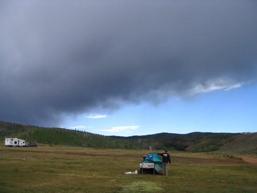
...Well, now that the sun's back, guess we might as well hit the road. Direction,
Tucker, Utah. (Note that the tent did'nt collapse, Marc is just folding it down...)
Kinda tight! It's for quads and motorcycles only (NO 4X4).
Rated: Moderate, very steep !
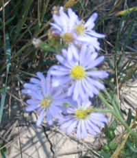
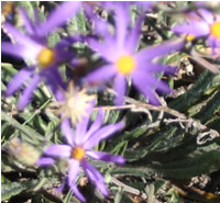
| There are all kinds of flowers of all kinds of colors along side the
trail. |
|

|
|
|
|
Now, you definetely know for sure, which one of us handles the camera...

Polaris
Industries - Canada
Polaris Industries - USA
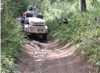 |
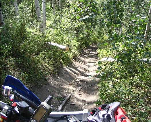
When we say trails are narrow, we mean it. Would'nt want to have to
back-up in that...Especially with a trailer...More often than not, we ride on the
sidewalls of the tires more than anything else. |
Aie, Aie, aie...Simonac !! (Let's just say it was a little less polite when it actually
happened...). There's not just one, there's two!
Decision time...
We rode...About ten miles since the last intersection...I don't remember seeing any place
where I could turn around...Back-up for ten miles...I don't think so...
Well, let's try something...(Note the size of the trunk compared to the size of the
saw...)
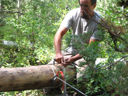
With a little help (actually a lot of help...) from the winch, it finally worked !!
Gees, Is it ever hot or what? Not sure if you know but, at 7000ft, the air is rare !!!
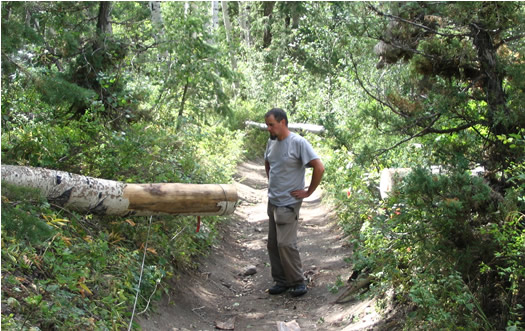
...And here's No2...Luckily, this one was a little smaller !
Coast is clear!! If the wind downed those 2, hopefully it did'nt down any other one...
 
Yeah ! Euuh...Hold on now...
 |
Soon as we think of something, we'll let you know... |
| Bof... |
Multiple bofs day today.... |
 |
Unreliable maps, rutted trails, dead-ends, downed trees, name
it... Simonac ! |
|
|
After riding another good 15 miles of steep, rutted, narrow trails, The GPS shows that,
if we keep going in that direction, we'll never reach Tucker (where the only trail going
south is suppose to be...). In fact we're following along highway 6. But, according to the
G.D. map...there was suppose to be a trail going to Tucker...
We finally find a trail that, after going through a sheep camp and following a dry
wash, takes us down to highway 6, but at the next village to the west:
Sky View, of which this is the only building...
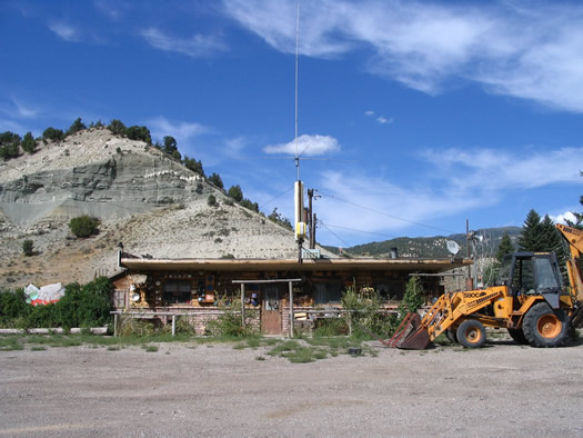
I'm telling you, really, it's on the map. I swear!
Luckily, we did'nt need gas...
So, here we are again in a dead-end, on a paved highway...Sound familiar?
On the way down here, we came across a railroad track that, according to the map, follows
the road...Maybe there's an access to Tucker on there somewhere??
Let's check it out...
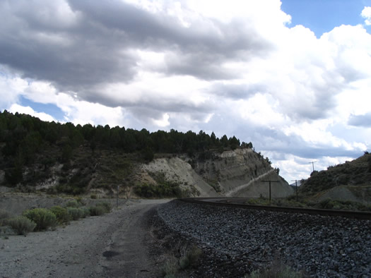
Since the tracks are about 200ft higher than the highway, we need an access road to get
down there. OH! Here's one ! But it brings us about 3/4 mile east of Tucker...
Now...Where in H... is that Tucker town? Can't see it anywhere. Guess it's kinda
small...If it really exists...
The only thing that says anything about Tucker (besides that ...map...) is a sign on
the side of the highway saying "Tucker rest area, 1/2 mile...
Let's check it out...
...Well......Tucker, IS a rest area !! There is NO
town !!
But the trail...Now...Where's the trail ??
...Of course !!! ...The trail, is IN the rest area !! Way back there,
behind the rest rooms ! Everybody knows that! Says right there on the map !! (Really!)
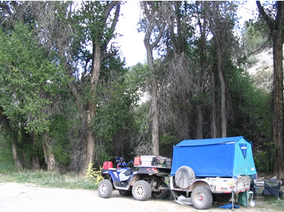 |
Soon as we're back on the trail, we follow a small creek and there are
plenty of spots where we can stop. Enough emotions for today, it's here we camp ! |
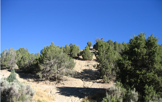
Here's what we see from across the trail. The vegetation is definetely changing...And
the sky...

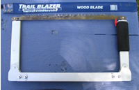
 Light, compact and
sometimes... essential...This little saw saved us from having to back track. On the other
hand, it has a tendancy to make room temperature go up substantially!
Made of aluminium, it's about 16X3 in. when collapsed and about 16X8 when opened.
Arm oil powered, it's very reliable and can help you out of a bad situation. (just
bring a spare blade, in case...)
Note: Level of efficency varies with user an altitude. |
The saw. 
|
Pour voir la liste de
tous les trucs,
cliquez ici
to see all the
tricks and infos
click here |
|
|
|
|


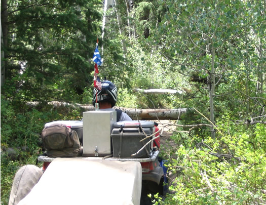
Rutted, access cut, steep...and Decorated with fallen
trees...
 
4 day total
| 84 |
Miles |
|
|
| 2080 |
Miles: ŕ date/to date |
|
|
|
|
| $0 |
Resto |
| $2 |
Épicerie/Food |
| $0 |
Essence/fuel |
| $0 |
Camping |
| $0 |
Divers/Misc. |
| $2 |
Total |
|
|
|
|
Budget busting expenses:
2 cans of coke from a machine at the infamous Tucker rest area.
Ahhh! Something cold...
 Déjeuner/Breakfast:
-toasts +coffee
-eggs + beans
-toasts + coffee
-tortillas + eggs
Dîner/Lunch:
-just a snack
-tomatoes+cucumbers+eggs +cheese
-cheese and broccoli soup
-just a snack
Souper/Dinner:
-just another snack...
-pastrami+olives+nachos+salsa
+cheese
-spaghetti
-saucisses |
 |
L'ITEM LE PLUS APPRÉCIÉ:
THE MOST APPRECIATED ITEM: |
| 
Nous sommes fiers de vous présenter nos partenaires.
Ils nous ont fourni un soutien important afin de nous aider ŕ réaliser cette aventure.
MERCI Ŕ TOUS
|
 We are proud to introduce you to our partners.
Their precious collaboration helped us live this fabulous adventure.
THANKS TO ALL. |

Polaris Industries -
Canada
Polaris Industries - USA


Cellutron


|
|